Every year, violent storms reshape coastlines, flatten communities, and remind us just how powerful the natural world can be. The facts about tornadoes and hurricanes are not just statistics — they reveal how these two storm systems form, behave, and differ in ways that genuinely matter for safety and preparedness.
Two storms, one atmosphere — but very different origins
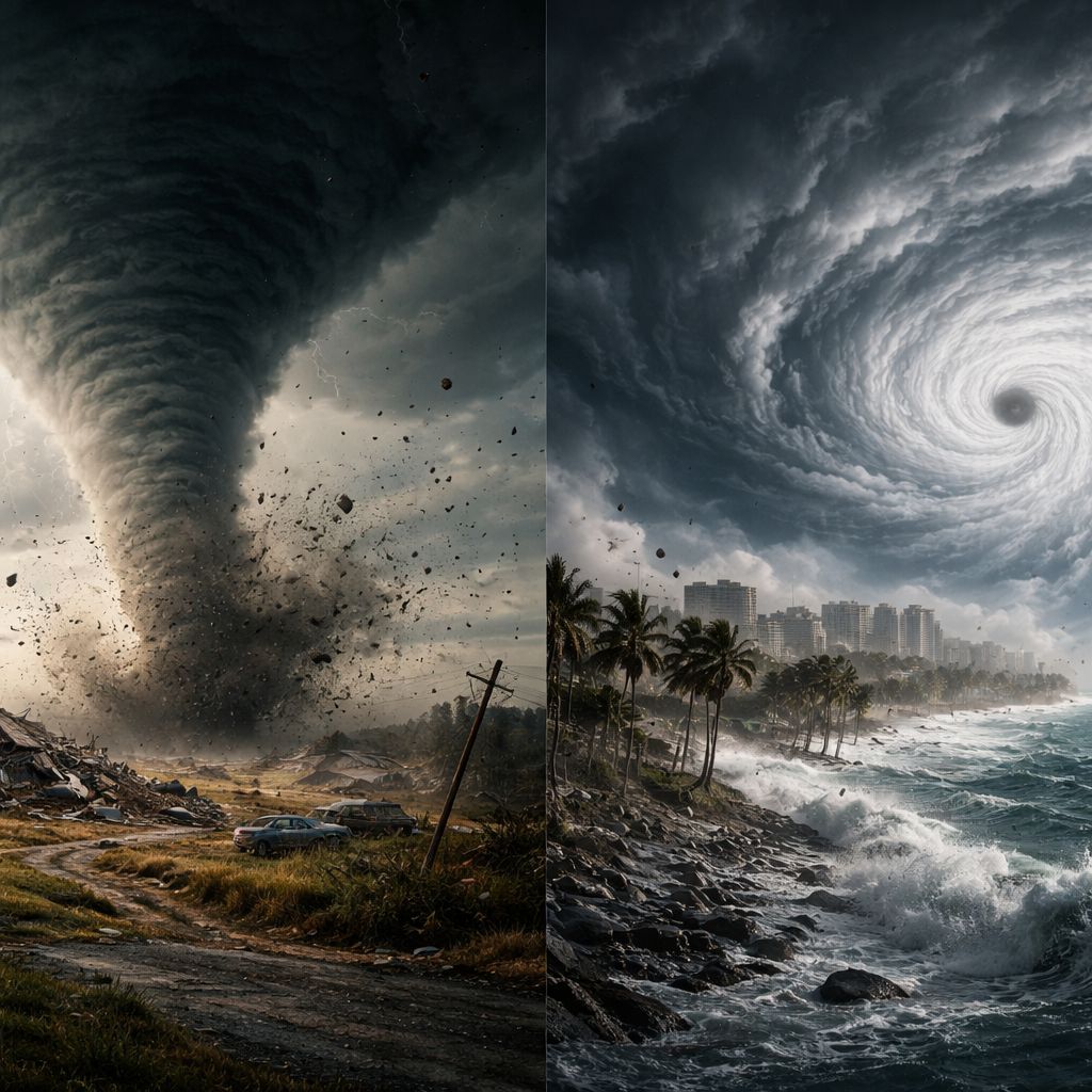
Tornadoes and hurricanes are both rotating wind systems, yet their birthplaces and life cycles are strikingly different. A tornado is a localized column of violently rotating air that stretches from a thunderstorm cloud to the ground. It can form within minutes, travel a narrow path, and dissipate just as quickly — sometimes in under an hour.
A hurricane, on the other hand, is a massive tropical cyclone that develops over warm ocean waters, typically above 26°C. It can sustain itself for days or even weeks, covering an area hundreds of kilometers wide. Where a tornado is sudden and concentrated, a hurricane is slow-building and sprawling.
The numbers that put things in perspective
Raw data helps make sense of just how extreme these weather events can be. Here is a side-by-side look at their key characteristics:
| Characteristic | Tornado | Hurricane |
|---|---|---|
| Average diameter | 50–100 meters | 300–600 km |
| Maximum wind speed | Up to 480 km/h (EF5) | Up to 300+ km/h (Category 5) |
| Duration | Minutes to a few hours | Days to weeks |
| Formation zone | Land (mainly) | Warm tropical oceans |
| Warning time | Often under 15 minutes | Several days in advance |
That warning time gap is one of the most critical practical differences. With hurricanes, evacuation is possible. With tornadoes, shelter must be found immediately.
How tornadoes actually form
The formation of a tornado involves a specific set of atmospheric conditions coming together at the right moment. It typically begins inside a supercell thunderstorm — a rotating thunderstorm with a well-defined structure called a mesocyclone. When wind direction and speed change dramatically with altitude (a condition called wind shear), the rotating air can tilt vertically, eventually reaching down to the surface as a funnel cloud.
The central United States — commonly known as Tornado Alley — sees the highest frequency of tornadoes in the world, largely because cold dry air from Canada collides with warm moist air from the Gulf of Mexico across flat terrain. This setup is almost ideal for supercell development.
According to NOAA, the United States experiences more tornadoes annually than any other country — averaging over 1,000 confirmed tornadoes per year.
The anatomy of a hurricane
A mature hurricane has a recognizable structure that meteorologists study in detail. At its center sits the eye — a calm, nearly cloud-free zone typically 30–65 km wide. Surrounding it is the eyewall, where the most intense winds and rainfall occur. Beyond that, spiral rainbands extend outward for hundreds of kilometers, dumping enormous amounts of rain long before the storm’s center arrives.
Hurricanes are classified using the Saffir-Simpson Hurricane Wind Scale, which runs from Category 1 (winds of 119–153 km/h) to Category 5 (winds exceeding 252 km/h). However, wind speed alone does not determine total destruction — storm surge, the wall of ocean water pushed inland by hurricane winds, is responsible for the majority of hurricane-related deaths.
What makes storm surge so dangerous
Storm surge can raise coastal water levels by 5–9 meters in extreme cases. Because the surge arrives rapidly and can extend miles inland, people in low-lying coastal areas face a drowning risk, not just wind damage. This is why meteorologists consistently emphasize that storm surge, not wind, is the deadliest element of a hurricane.
Comparing destruction: intensity vs. scale
A common question people ask is which storm is more destructive. The honest answer depends entirely on what you measure. An EF5 tornado produces the highest wind speeds ever recorded in any weather system on Earth — the 1999 Bridge Creek–Moore tornado in Oklahoma was clocked at approximately 486 km/h. No hurricane comes close in terms of peak wind velocity over a small area.
Yet in terms of total economic damage, energy released, and lives affected across a region, hurricanes cause far greater cumulative destruction. A single major hurricane can release energy equivalent to thousands of nuclear bombs over its lifetime and displace millions of people.
- Tornadoes are more deadly per square kilometer affected
- Hurricanes affect far larger geographic areas and populations
- Flooding from hurricanes often causes more deaths than wind
- Tornado damage is typically narrower but more total within its path
- Both systems can trigger secondary hazards: hail, lightning, flash floods
What science still does not fully understand
Despite decades of research, predicting exactly where a tornado will touch down remains one of meteorology’s hardest challenges. Scientists can identify favorable conditions, but the specific trigger that causes one supercell to produce a tornado while another does not is still not fully explained. Doppler radar and storm-chasing data have improved short-term warnings, but precision remains elusive.
With hurricanes, intensity forecasting — predicting how strong a storm will become — continues to challenge researchers. Rapid intensification, when a hurricane’s winds increase by 55 km/h or more in just 24 hours, can occur with little warning even when track forecasting is relatively accurate. Warm ocean eddies beneath the surface play a key role, but modeling them in real time is still an active area of research.
Climate change and shifting storm patterns
Research published in peer-reviewed journals indicates that as ocean temperatures rise, the conditions that support intense hurricanes are becoming more widespread. Studies suggest that while the total number of tropical storms may not necessarily increase, the proportion reaching higher intensity categories is likely growing. Tornado patterns are also being studied in relation to shifting jet streams, though the connections are less straightforward than with hurricanes.
Staying safe when the sky turns dangerous
Understanding how these storms behave translates directly into practical decisions that can save lives. The guidance from emergency management agencies is clear and consistent:
- For tornadoes: move to an interior room on the lowest floor, away from windows — a basement is ideal
- For hurricanes: follow official evacuation orders without delay, especially in coastal and flood-prone zones
- Never shelter under a highway overpass during a tornado — wind acceleration in that space increases danger
- Prepare an emergency kit regardless of where you live, since both storms can cut off power and water for days
The Federal Emergency Management Agency (FEMA) recommends having at least 72 hours of emergency supplies ready, including water, food, medications, and important documents stored in a waterproof container.
When knowing more actually changes everything
There is something genuinely useful about understanding these storms beyond the fear they inspire. Knowing that a tornado warning means a funnel has been spotted or detected — versus a tornado watch, which means conditions are favorable — can determine whether you act immediately or simply stay alert. Knowing that a hurricane’s outer rainbands can drop a foot of rain hundreds of kilometers from the eye helps you understand why inland flooding kills people far from the coast.
Both tornado science and hurricane research have advanced enormously thanks to satellite imagery, airborne reconnaissance, and community-based storm reporting networks. The gap between what we know and what we can predict continues to narrow — and for people living in storm-prone regions, that progress is anything but abstract. It is the difference between a warning that arrives in time and one that does not.